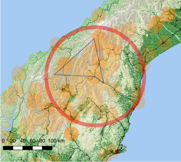
This is an example of setting a task. The task is a 300k 28% triangle.
Task was flown from Omarama on the 27th of January 2018.
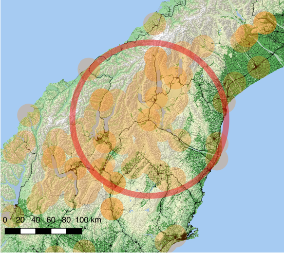
The task area is approximately a 120k radius from Omarama. This map shows the area available for the task inside the red circle centered on Omarama.
As this task is being flown in thermals the only controlled airspace below 9500ft in the task area is between Wanaka and Queenstown near the Cardrona valley. It is going to be easy to stay clear of that area, so there are no significant airspace issues with a task this size.

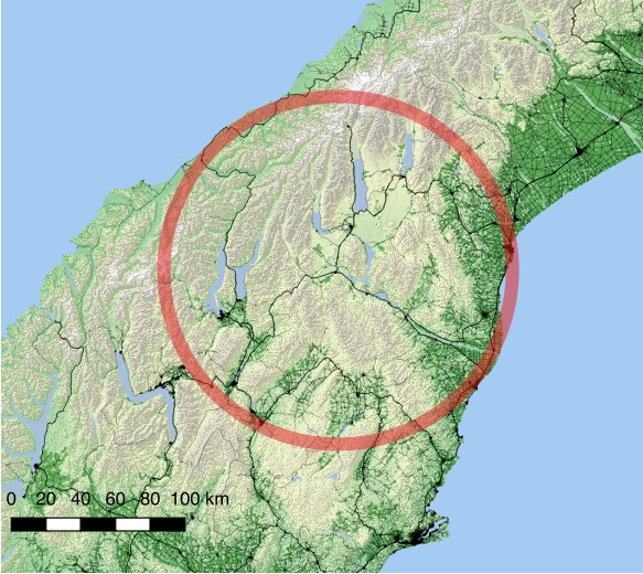
At Omarama we have very good landout options. This map shows the landouts and airfields in the turnpoint database with fifteen kilometer circles.
As you can see, even allowing a very conservative glide, there are few areas in the task area that don't have easy access to a good landing option. You just have to know where they are. It is not unrealistic to double the ize of the circles shown if you are on the tops of the mountains at six or seven thousand feet. Most of the landouts are at one to two thousand feet elevation and could be easily reached from thirty kilometers away.
The weather for the day was light winds, a little cloud.
The satellite picture from 7am shows a front moving on to the south of the South Island (The surface pressure chart shows this as a trough).
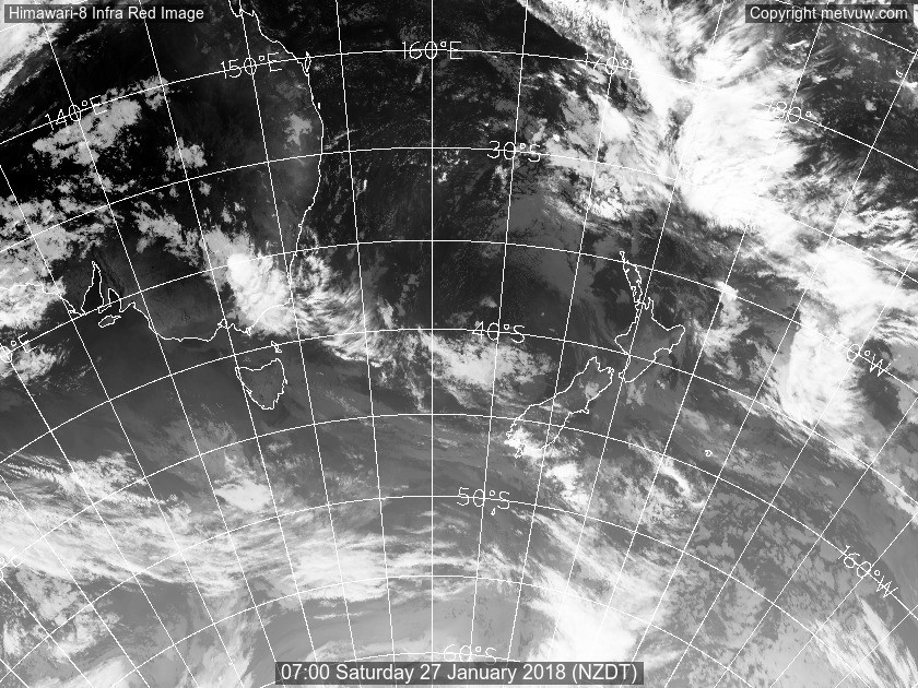
Surface pressure chart shows a high pressure over the South Island, with a trough moving up from the south later in the afternoon.
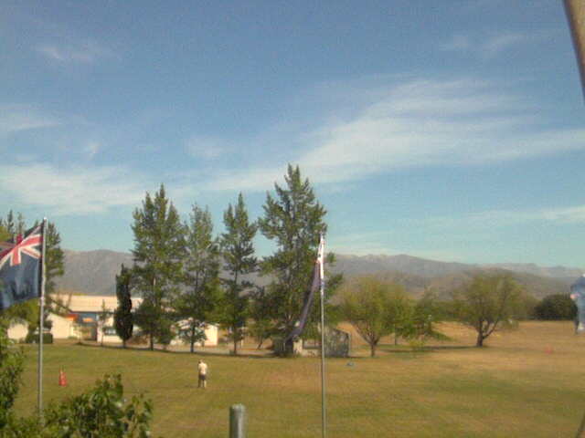
By 11am the sky looked like this:
Checking the sounding and thermalling height forecast it looks like thermals will get useable local to the airfield around midday and be much better closer to the divide. It looks like the day will shut down early, with the easterly coming in before 5pm as the trough coming up from the south pushes cloud and cool air up the coast and over the coastal areas. Wind in the boundry layer is light, meaning no significant ridge or wave, but good conditions for thermal and convergence.


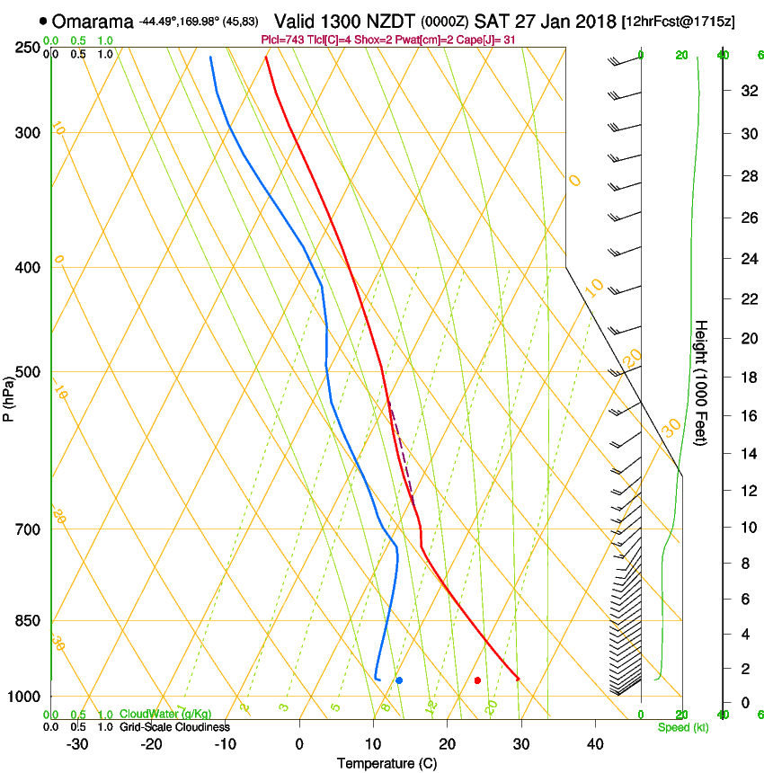

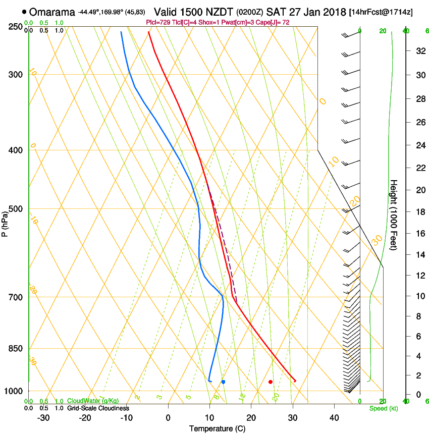

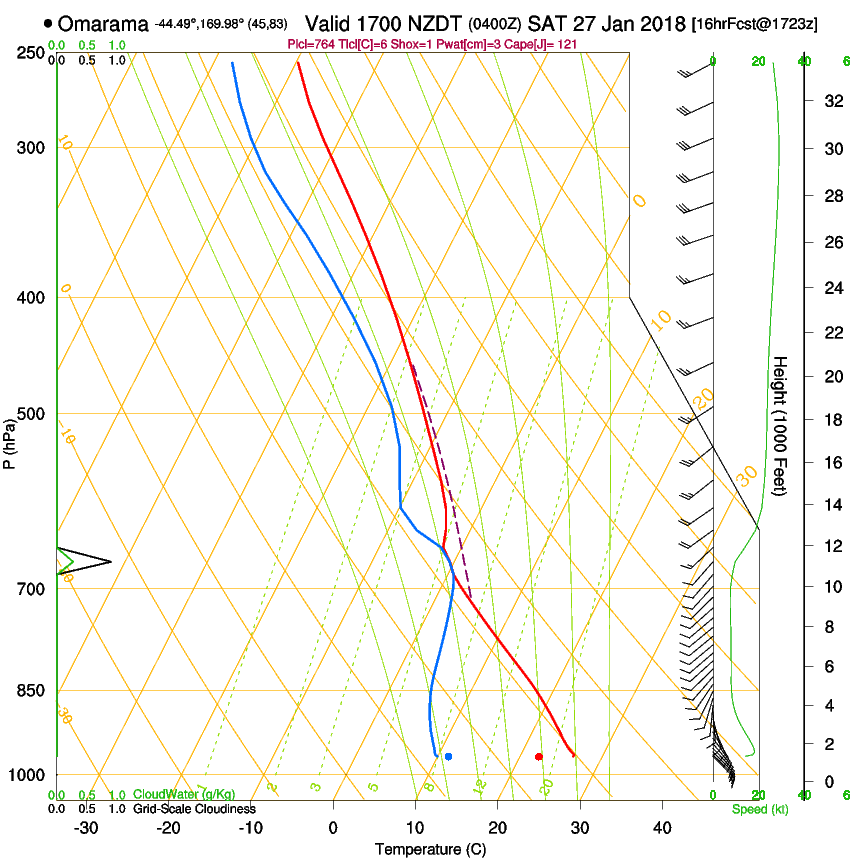
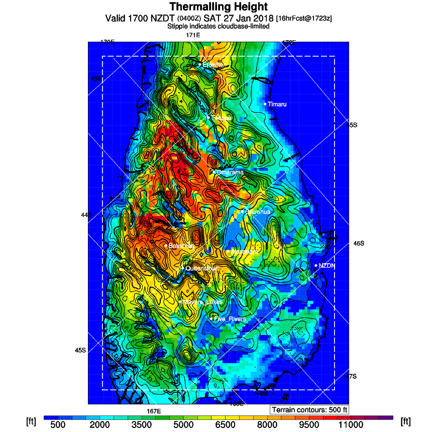
Cloud looks good with high cloudbases over the mountains giving plenty of working height and marking the thermals. Blue in the morning with cloud marking once the thermals get going high enough to be useful.
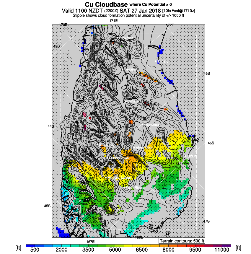
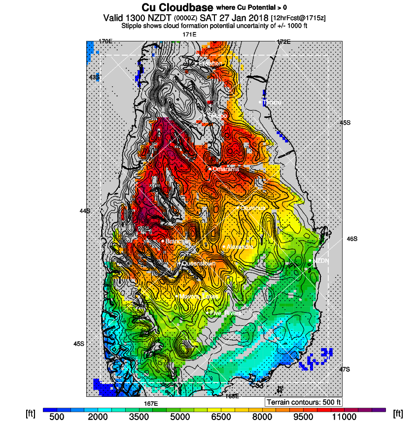

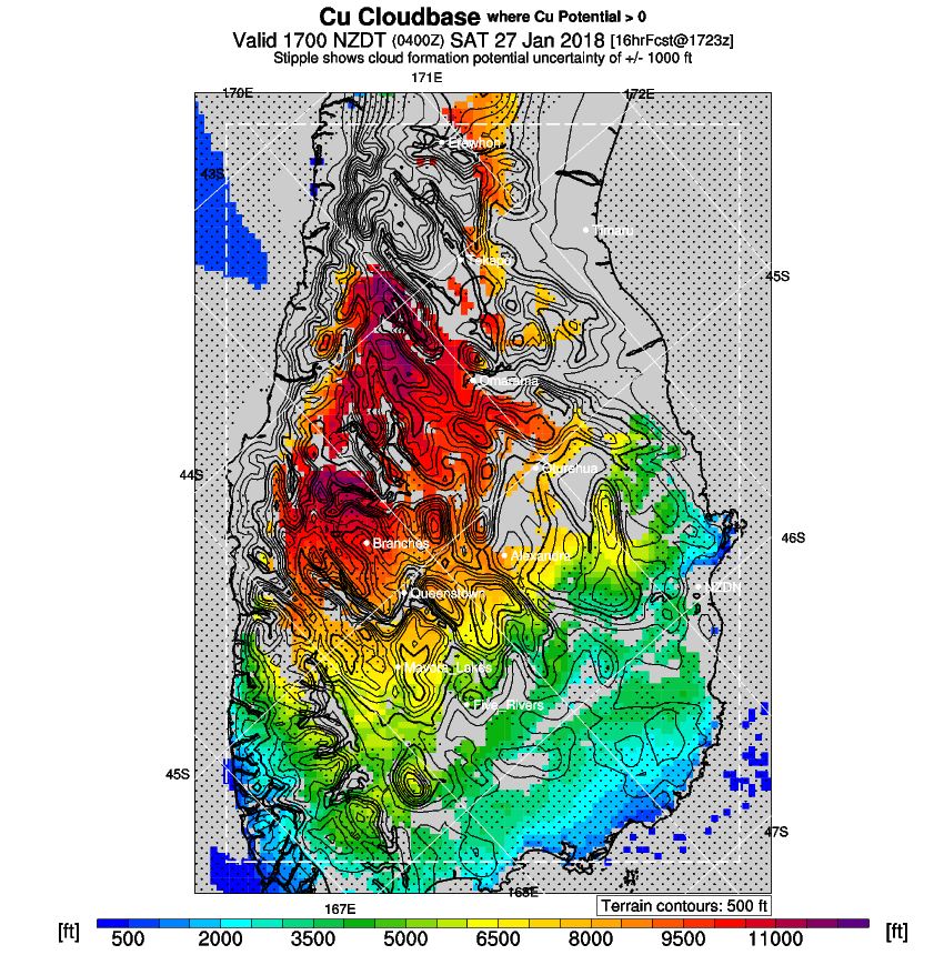
A quick look at the boundry layer up/down shows energy lines along the big mountain ranges to the west and north and convergences on the east side of the basin.
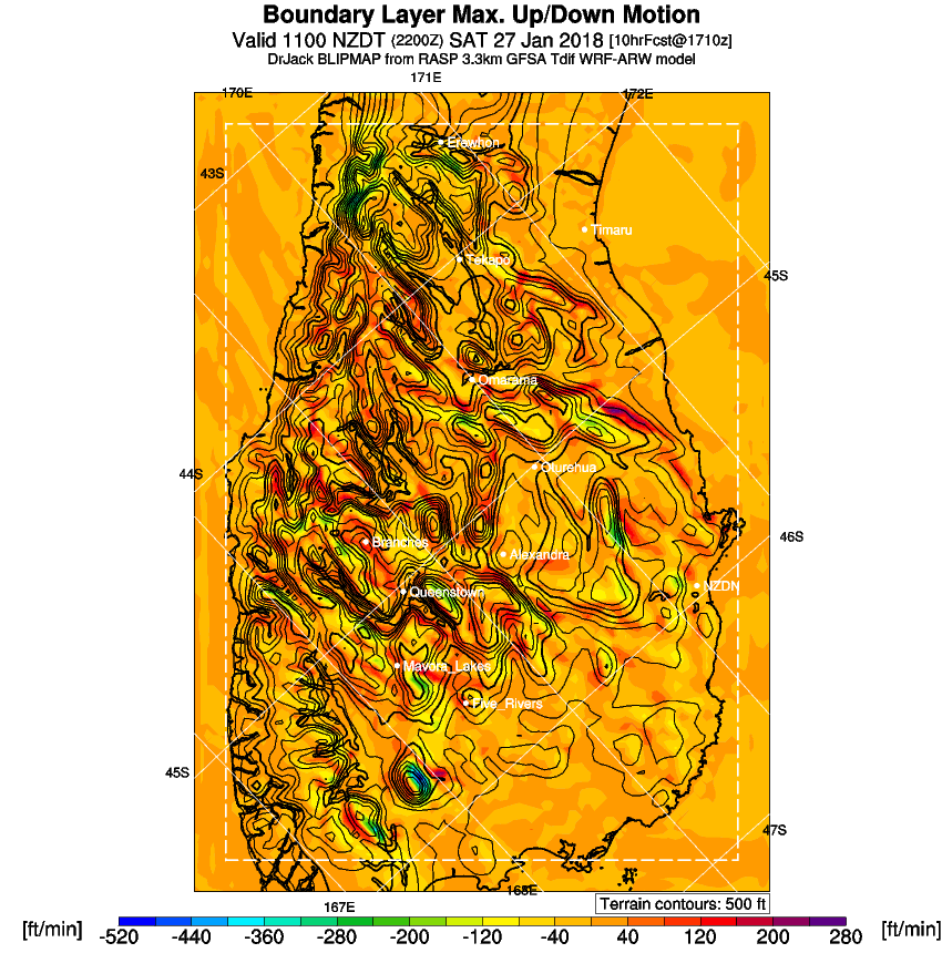

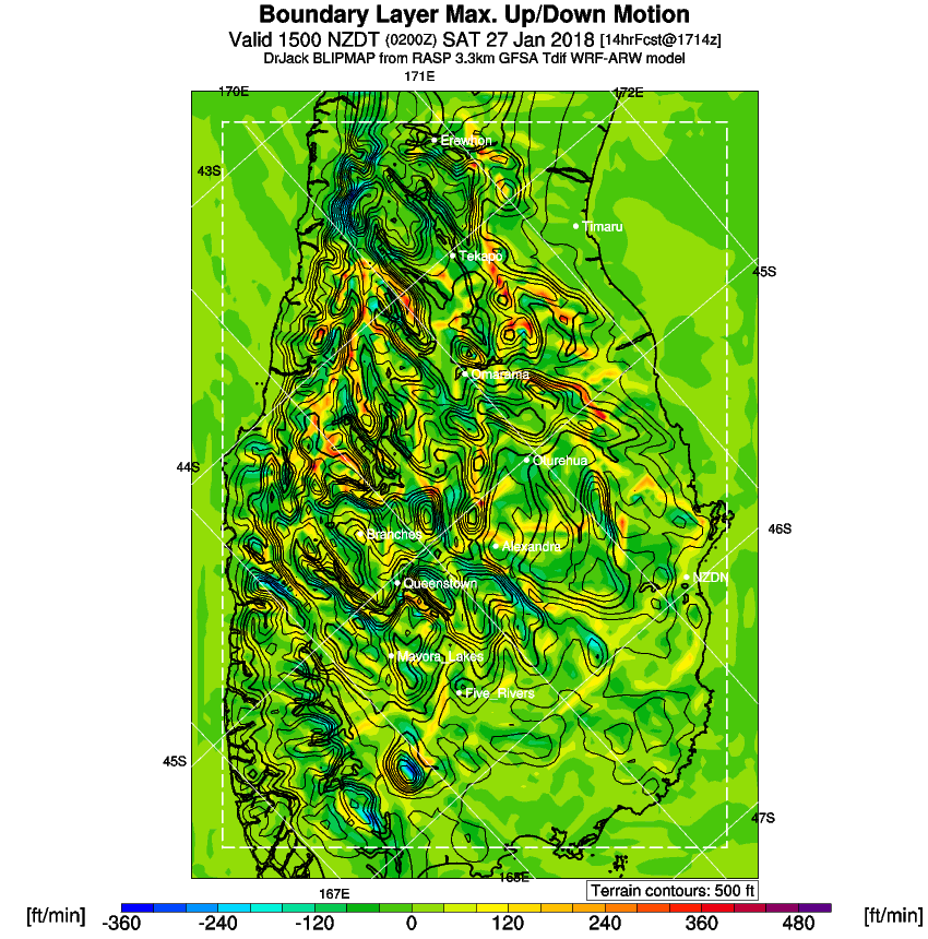
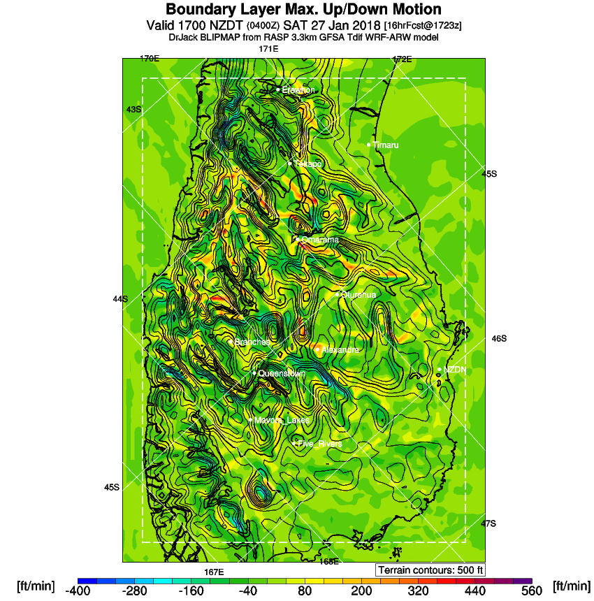
The good energy should be to the west of Omarama out to the Divide. It should be good along the east side of the Divide up to the Mt Cook area. There should be good energy along the Dobson all afternoon.
I selected turnpoints to take advantage of the best energy lines.